TRMM-GPM Data Service

Since 2010, WRA has been actively using TRMM data for water resource and flood defence projects, particularly in areas of sparse data. Our TRMM data service provides continuous rainfall time-series and rainfall intensity-duration-frequency [IDF] curves for any point on the globe between the 50 degree latitudes, in formats which are easy to use for hydrological analysis.

WRA’s IDF software analyses TRMM rainfall by quarter degree grid cell for any duration between 3 and 72 hours for the post-1998 period, a record of 192 months of short-duration rainfall data.

This global database and software system can provide a rapid response to project requirements anywhere in the Earth’s tropical and sub-tropical regions. An IDF relationship can be derived or specific storm events can be investigated for any location with relative ease.

The data have been used, tested and validated by WRA in Africa, the Middle East and Far East, by comparison of statistics with ground stations, and the software is undergoing further development.

WRA Processed Data Service

WRA provides processed rainfall and IDF data as a commercial service for clients, and the pricing is based on the number of quarter degree grid cells per grid cell and number of IDF curves and tables provided.

Data-sets are provided in ASCIii Text file format.

Nomenclature:
  • Blocks: Rectangular arrays of TRMM cells (current limiting size 40 x40 cells)
  • Locations: Individual cells eg raingauge locations (current limit 10 locations)
  • Sub-basins: Defined by array from GIS intersection of sub-basins with TRMM cells (current limit 10 sub-basins)
  • GRID: Ascii GRID files
  • TXT: Text file
  • IDF: Intensity-Duration-Frequency
Open all Close all
  • About TRMM-GPM
    TRMM data were acquired as part of the activities of NASA's Science Mission Directorate, and are archived and distributed by the Goddard Earth Sciences Data and Information Services Center
    Alt image
    trmm-sys, wra, water-resource-associates, uk-water-consultants, software
  • TRMM Grid cells across a large river basin
    The Tropical Rainfall Measuring Mission (TRMM) is a joint NASA-JAXA [Japanese] satellite mission to monitor tropical and subtropical precipitation and to estimate its associated latent heating. TRMM was launched in November 1997 and provided Real-Time Multi-Satellite Precipitation Analysis until 2016 when the satellite was decommissioned. The maps below show the distribution of TRMM rainfall across a river basin in four different rainfall events.
    Alt image
    trmm-data, wra, water-resource-associates, uk-water-consultants
    Alt image
    TRMM-output1, wra, water-resource-associates, uk-water-consultants
    Alt image
    trmm-output2, wra, water-resource-associates, uk-water-consultants
    Alt image
    trmm-sys, wra, water-resource-associates, uk-water-consultants
    Alt image
    trmm-output4, wra, water-resource-associates, uk-water-consultants
    TRMM data represent an a real rainfall averaged across the grid cell, as opposed to a point-rainfall, measured at a rainfall station. The areal measure of rainfall in each cell varies with latitude, and grid-cells are 28 by 28 km at the equator, which represent an area of 784 km2. [http://pmm.nasa.gov/node/158].
  • GPM
    The TRMM satellite ended data collection in April 2015 (see http://pmm.nasa.gov/trmm/mission-end). Launched in November 1997, the TRMM satellite delivered a unique 17-year dataset of global tropical rainfall and lightning. The data collection started by TRMM continues with the joint NASA/JAXA Global Precipitation Measurement (GPM) mission, which launched in February 2014.

    WRA developed a systematic procedure for linking the TRMM data-set with the GPM data, thereby providing a global data-set starting in 1998 and extending into the future over the working life of the new satellite.

    GPM offers two options: the raw data (GPM V03E RT) and the calibrated data (GPM V03D). Historically, WRA used the TRMM data calibrated against reference ground stations. So only calibrated GPM is used, which is a month or two delayed as the calibration and adjustment is done monthly in arrears.

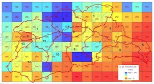
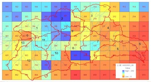
    The GPM data have a higher resolution, available at 0.5 hourly intervals and with an aerial coverage of only 0.1 degree squares. The latitudinal range has also been extended to 60 degN - 60degS. However, the Mirador site continues to adopt the TRMM style coverage of 3-hourly over 0.5 degree squares by using a spatial and temporal merging procedure, possibly part of the "imerge" process described by NASA. These merged data files are in HDF-EOS format and can be downloaded, but not directly as with the TRMM data.
© 2024 Water Resource Associates LLP | Website by Boray Designs

Privacy Policy Cookie Policy