Wetlands

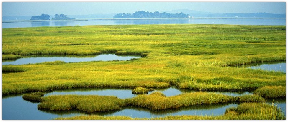
Wetlands play a special role in the hydrology of many river systems. While being inundated for all or part of the year, the depth of flooding is usually fairly shallow and seasonal. These special characteristics - different from those of surrounding regions - provide habitat for rare animals and birds.

Inevitably, wetlands are very sensitive to upstream development. Storage of water in reservoirs, diversion for irrigation, and flood control works can all impact on the natural balance of wetlands. Water quality can also be affected. Thus, an understanding of the hydrological system is a prerequisite to other environmental and ecological studies. Nevertheless, wetlands can play a vital role in some aspects of development.

Water Resources: storing water at times when other river systems are dry, they can be used as a perennial source of water.

Flood Control: wetlands have tremendous capacity to act as buffers to floods. Indeed, flood plains can be considered as a specific case of wetlands. Riparian development often removes the buffering effects and leads to increased flooding downstream.

Pollution Buffering: suspended sediment settles out in wetlands that hold water for a long period with very low flow velocities. Reeds and other aquatic vegetation can absorb some organic pollutants.

Fish Hatcheries: the shallow water depths and low velocities are ideal as hatcheries for certain types of fish.
  • wra, water-resource-associates, uk-water-consultants, wetlands

    Caption Text

    Link

WRA Experience

wra, wetlands
Turkey
Until the development of artificial irrigation in the Goksu delta on Turkey’s Mediterranean coast, there were only a few lagoons with very salty water which dried out completely in the summer. Since the development of irrigation the return water from the irrigation system has created a series of lagoons which are important for migratory birds and fishing. The overall aim of the project was to assess the long-term viability of the lagoons. WRA provided a short term specialist hydrological input. Using data collected by project staff and DSI (the organisation which had developed the irrigation system) a model of the lagoons was developed. The data were sparse, at best monthly (rainfall and evaporation) and in some cases every two months (quality data in the lagoons) for a five year period. There was little information on flow between lagoons so the model was calibrated using data on levels of salinity.
Botswana
The Okavango river rises in the humid mountains of Angola. From there it flows through Namibia and into Botswana where it forms an inland delta. The Okavango Delta is an internationally recognised wetland and home of a wide variety of wild life. Due to a persistent drought the Government of Namibia was considering abstractions from the Okavango river as an emergency measure. As part of the study of the possible abstraction a number of complementary studies were undertaken including one on the downstream environmental effects. This study was co-ordinated by the South Africa CSIR and WRA was brought in as a specialist consultant to study the possible hydrological effects on the delta. The wetland model used was a development of a model developed earlier by a WRA Director which took account of the losses from open water and vegetated land around the delta. The model divided the delta into 12 cells and simulated flows and areas in each cell.

In addition our Associates have also worked in:

wetlands, wra
Botswana
  • The Okavango River rises in the humid mountains of Angola and flows southwards into the Kalahari desert. There, at the southernmost limit of the great Africa rift valley, the water is held behind a small geological displacement a few metres high and spreads out to form the Okavango Delta - an area internationally famous for its wildlife.
  • Vigorous international opposition to proposals for water supply developments at the southern end of the Delta led to an IUCN-funded review, which included hydrological investigations and modelling of the swamp system. Conjunctive use of surface and groundwater was found to be more economical and reliable and to have negligible impact on the environment.
Iraq
  • The marshes of southern Iraq, at the confluence of the Tigris and Euphrates rivers, have for long provided the basis of a unique lifestyle in this otherwise arid region. Drainage works in recent years could be damaging, or even drying out, some of the marsh areas, and they are also affected significantly by upstream development.
  • An international study supported by the AMAR Appeal reviewed the impact these developments. The operation of all storage, diversion and flood control works in the Tigris and Euphrates basins were modelled over the historical time series to predict the continual reduction in water supply to the marshes. It concluded that present and planned works upstream of the delta are such that little could be left of the marshes after 10 to 15 years.
Romania
  • The Danube delta in Romania is important as a source of fish protein and for many bird species. Dredging work over the last few decades has enabled flows from the river to pass more quickly into the shallow lakes, bringing silt and pollutants such as Phosphates.
  • A mathematical model of part of the delta was prepared as part of a strategic planning study, which proposed to reduce the spread of eutrophication by closing off some of the newly dredged channels encouraging flow through reed beds.
© 2024 Water Resource Associates LLP | Website by Boray Designs

Privacy Policy Cookie Policy